Scientists Sail the Southern Seas: Oceans absorbing the heat of climate change
Science Victoria Edition
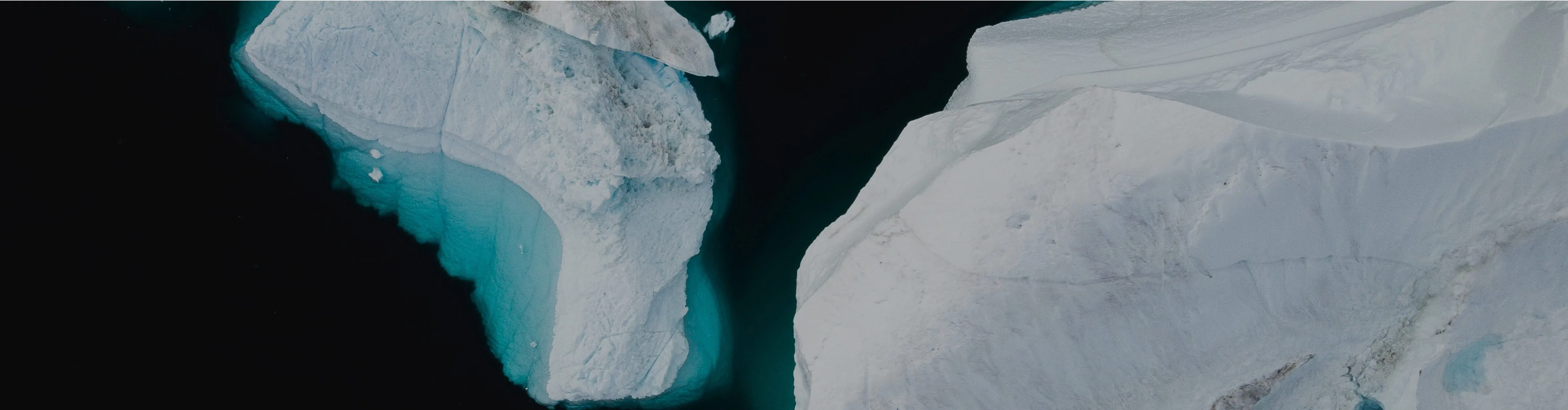
%20Investigator%20-%20Credit_%20CSIRO.avif)


By Amelia Pearson
Monash Climate Change Communication Research Hub
The Southern Ocean is a 'natural laboratory' for vital scientific research, impossible to achieve anywhere else on the planet.

The Southern Ocean
The Southern Ocean surrounds Antarctica, boasting colossal waves that even the bravest sailors find daunting.
The dangerous waves, volatile weather, and distance from any land make it inaccessible, and one of the least observed regions on the planet.
However, these stormy seas are key to our survival and are critical for us to understand in the face of global climate change.1 Of all the oceans, the Southern Ocean absorbs the majority of human-generated heat and carbon,2 helping to slow the pace of climate change and keep our Earth liveable. In addition, Antarctic sea ice acts as an 'air conditioner' for our planet, reflecting 50-70% of incoming solar radiation.3,4
Together, these factors influence ocean circulation and climate on a global scale, and control the rate that the Antarctic ice sheet is melting – the greatest uncertainty in projecting future sea level rise.
The Antarctic Circumpolar Current
At the heart of the Southern Ocean is the Antarctic Circumpolar Current (ACC) – Earth's strongest current, driven by westerly winds. It flows clockwise around Antarctica, and for millions of years it has acted like a shield, keeping heat away from the icy continent.

The ACC is up to 2,000 km wide, and runs through the ocean from the surface to seafloor. Where it encounters underwater barriers like seamounts or ridges, 'wiggles' are created in the water flow, forming eddies.
We can think of eddies – water spinning off in the opposite direction to the main current – as the weather systems of our oceans, playing a vital role in moving heat through the ACC to the waters around Antarctica and also into deeper layers.
Although the ACC has always let some warmth through, changing winds over the Southern Ocean are expected to increase the southward transport of heat, accelerating ice melt in Antarctica and sea level rise.5
Ocean mapping has identified five eddy hot-spots, thought to be the primary "gateways" for this heat transfer, and one of these sits about half way between Hobart and Antarctica.

FOCUS on the high seas
On 15 November 2023, a team of 54 scientists and crew set sail from Hobart aboard CSIRO's state-of-the-art research vessel (RV) Investigator, and voyaged south to the heart of this eddy hotspot in the Southern Ocean.6
Their mission: to collect high resolution data that will help us understand the ocean dynamics happening now, and how they may change in the future.
The aptly named FOCUS voyage – Fine-scale Observations of the (Antarctic Circumpolar) Current Under SWOT – was co-led by CSIRO and the Australian Antarctic Program Partnership, in collaboration with NASA and France’s space agency (CNES), Woods Hole Oceanographic Institution (WHOI), and the California Institute of Technology (Caltech).7,8
Over five weeks, the ship sailed 850 nautical miles south, to reach the 100 km by 200 km survey area.
Here, the interdisciplinary team of oceanographers, hydrochemists, biologists, geophysicists, and engineers aimed to track down and measure the small-scale features they think can explain the heat seeping polewards.
To do this, they needed to collect data from both above and below the waves.
Science from space
Orbiting over 890 km above us, the SWOT satellite plays an important role in this research. Co-designed by NASA and French space agency CNES, it measures the height of the ocean surface from space, providing vital information on the density and speed of ocean currents.9
The SWOT satellite has 10 times better resolution than preceding satellites, and can detect differences in sea surface height down to just a few centimetres.

Co-chief scientist Assoc Prof Helen Phillips, from the Australian Antarctic Program Partnership at the University of Tasmania, likens it to a short-sighted person looking at a tree in the distance and then putting glasses on to reveal all the leaves.
As the SWOT satellite flies over the ocean, it records the shape of the ocean surface and captures the eddy hotspots spinning off the ACC.
This means scientists can see the smaller-scale circulation features, which are thought to be responsible for most of the ocean’s heat and carbon transport from the surface to the bottom of the ocean. In turn, it will allow them to turn daily maps of ocean sea surface height from satellites into daily maps of heat movement in the Southern Ocean towards Antarctica.
CSIRO researcher and voyage chief scientist Dr Benoit Legresy says that "this new capability to map the ocean will boost our capacity to monitor and forecast the ocean very much like we forecast the weather".
The SWOT satellite will also provide an eye in the sky for the deep south when researchers are not at sea, surveying the entirety of the Southern Ocean.

Exploring below the waves
At sea, the team relied on the scientific capabilities of RV Investigator to peer below the surface.
At the core of the operation is a 3.5 km tall mooring – 11 times the height of the Eiffel Tower. This vertical string of over 50 oceanographic instruments acts as a central point to connect what's happening below the surface of the ocean with what the satellite observes above.
Around this central feature, CTDs (conductivity, temperature, and depth sensors) and floats survey the depths of the ocean, while remotely piloted gliders are used to target specific ocean features like eddies.

Graduate student from Caltech, Luna Bai, says that the gliders “are like a more versatile CTD that take high frequency measurements of temperature, salinity, particles in the ocean, and dissolved oxygen".
Moving towards the surface, we find two final pieces of equipment. During satellite passes, the box-shaped Triaxus is towed behind the ship to map the upper ocean. And, at the surface, drifters hitch rides with swirling eddies and give us information about current speed and direction as well as surface pressure and temperature.
Together, this state-of-the-art toolkit provides insight into the vertical movement taking heat and carbon out of the atmosphere and putting it into the ocean. And when paired with SWOT's high definition view of the surface, we're able to put together a three-dimensional picture of what is driving these processes.

Connection to climate and life on land
Changes in the Antarctic region are happening much more rapidly and on a much larger scale than we ever thought possible. And now, we're in a race against time to understand why. Antarctica is like a 'sleeping giant', beginning to wake up and show its destructive potential as the planet warms.
Rapidly melting polar ice sheets and glaciers have contributed around two-thirds of our observed global sea level rise in the last few decades, with the other third comes from thermal expansion of the ocean waters.10,11 In addition, nearly 50 Antarctic ice shelves have shrunk by 30% or more since 1997.12

Let's zoom in on the past few years. In 2022 East Antarctica experienced an extraordinary heatwave, with temperatures up to 40 degrees above average, while in 2023 we witnessed Antarctic sea ice reach its lowest winter extent on record.13,14 Unfortunately, the start of this year followed a similar trend, with sea ice extent during February reaching another near-record low.15
These record-breaking lows may be the new normal and the beginning of the inevitable decline in Antarctic sea ice, which has long been projected by climate models.
A study published in Nature said that warming has increased to the point that some ice sheets will now experience "unavoidable" melting – regardless of how much greenhouse gas emissions are reduced.16 An increasingly 'leaky' ACC will likely only exacerbate these changes.
For Australia, continued ice melt exposes many of our most populated communities to the crippling consequences of sea level rise. This could include the loss of up to 50 per cent of its beaches over the next 80 years, along with damage to coastal communities from more severe storm surges, and flooding.17
Lessons for future FOCUS
The FOCUS voyage showcases the highly collaborative, international science required to better understand warming across our Southern Ocean. The data will be really valuable for helping people develop models of the Southern Ocean that reproduce what we see in the real ocean, and build confidence in those models for their other job of projecting our future under climate change.
It will also help governments plan their responses to ocean warming and rising sea levels, and hopefully motivate a faster reduction in CO2 emissions.
As we transition towards a net-zero world and atmospheric carbon levels begin to stabilise, the oceanographic toolkit used on this voyage will be essential to monitor the response of the Southern Ocean and our broader climate system.
A/Prof Phillips says, "the ocean is so enormous, and there aren't that many oceanographers and ships out here taking observations. This means that it has to be a really collaborative, international activity, with all data shared publicly, and a strong commitment to training the next generation of scientists”.
Ultimately, the more opportunities scientists have to work in these rugged, remote locations, linking data from satellites, research ships and other monitors, the better equipped we will be to tackle our rapidly changing world.
Acknowledgement
This research is supported by a grant of sea time on RV Investigator from the CSIRO Marine National Facility which is supported by the Australian Government’s National Collaborative Research Infrastructure Strategy (NCRIS).
–
Amelia Pearson is the Operations Manager for the Monash Climate Change Communication Research Hub, which provides new content, knowledge and ideas to support the effective communication of climate change impacts and solutions. You can learn more about the Hub's work at monash.edu/mcccrh.
References:
- Constable, A. J., et al. (2023). Marine Ecosystem Assessment for the Southern Ocean: Summary for Policymakers. Zenodo (CERN European Organization for Nuclear Research). doi.org/10.5281/zenodo.8359585
- Kiest, K. (2023, April 26). One of the planet’s most important carbon sinks is revealing its secrets. NOAA Research. research.noaa.gov/2023/04/26/one-of-the-planets-most-important-carbon-sinks-is-revealing-its-secrets/
- Quick Facts About Sea Ice. National Snow and Ice Data Center (NSIDC). nsidc.org/learn/parts-cryosphere/sea-ice/quick-facts-about-sea-ice
- Romanova, V., et al. (2005). Effect of land albedo, CO2, orography, and oceanic heat transport on extreme climates. Climate of the Past Discussions, 1(3), 255–285. doi.org/10.5194/cpd-1-255-2005
- Cai, W., et al. (2023). Southern Ocean warming and its climatic impacts. Science Bulletin, 68(9), 946–960. doi.org/10.1016/j.scib.2023.03.049
- CSIRO. (n.d.). Research vessel (RV) Investigator. CSIRO. Retrieved April 2024, from mnf.csiro.au/en/RV-Investigator
- CSIRO. www.csiro.au/
- The Australian Antarctic Program Partnership (AAPP). aappartnership.org.au/
- Surface Water and Ocean Topography (SWOT) - NASA. swot.jpl.nasa.gov/
- O’Neill, I. J., & Lee, J. (2020, March 16). Greenland, Antarctica Melting Six Times Faster Than in the 1990s. Climate Change: Vital Signs of the Planet. climate.nasa.gov/news/2958/greenland-antarctica-melting-six-times-faster-than-in-the-1990s/
- CSIRO. (2022). State of the Climate. CSIRO. csiro.au/en/research/environmental-impacts/climate-change/state-of-the-climate
- Davison, B., et al. (2023). Annual mass budget of Antarctic ice shelves from 1997 to 2021. Science Advances, 9(41). doi.org/10.1126/sciadv.adi0186
- Bergstrom, D. M. (2024, January 10). 2024: A heatwave in Antarctica totally blew the minds of scientists. They set out to decipher it – and here are the results. University of Wollongong. uow.edu.au/media/2024/a-heatwave-in-antarctica-totally-blew-the-minds-of-scientists-they-set-out-to-decipher-it--and-here-are-the-results.php
- Scott, M. (2024, February 28). Antarctic sea ice summer minimum ties for second-lowest on record in 2024. Climate.gov; NOAA. climate.gov/news-features/event-tracker/antarctic-sea-ice-summer-minimum-ties-second-lowest-record-2024
- Charctic Interactive Sea Ice Graph | Arctic Sea Ice News and Analysis. NSIDC. nsidc.org/arcticseaicenews/charctic-interactive-sea-ice-graph/
- Naughten, K. A., et al. (2023). Unavoidable future increase in West Antarctic ice-shelf melting over the twenty-first century. Nature Climate Change, 13, 1–7. doi.org/10.1038/s41558-023-01818-x
- Vousdoukas, M. I., at al. (2020). Sandy coastlines under threat of erosion. Nature Climate Change, 10(3), 260–263. doi.org/10.1038/s41558-020-0697-0
Other articles of interest


Discover how you can join the society
Join The Royal Society of Victoria. From expert panels to unique events, we're your go-to for scientific engagement. Let's create something amazing.